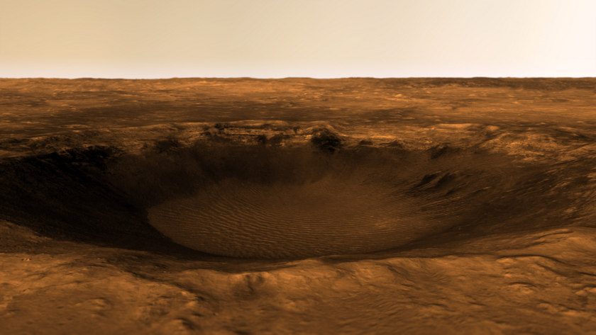
By: Kevin Gill, The Planetary Society
We have two rovers on Mars: Curiosity and Opportunity, which are our only current means of acquiring on-the-ground imagery of the planet’s surface. As beautiful and awe-inspiring as these pictures are, they are limited to where the rovers go.
Take this panorama, for instance, imaged by the Opportunity rover back in 2010:

Using images like this as both benchmarks and inspiration, I use real spacecraft data to approximate ground-level views of other places on Mars.
To do this, I work with two forms of data: Digital Terrain Models (DTMs) and satellite imagery. Simulating a camera on the ground requires very high resolution data, on the order of one or two meters per pixel. The best source for this data comes from HiRISE, the High Resolution Imaging Science Experiment, which is essentially a telescopic camera aboard the Mars Reconnaissance Orbiter. HiRISE is operated for NASA by the Lunar and Planetary Laboratory at the University of Arizona.
Here’s just one example of HiRISE data turned into a landscape:

The HiRISE folks create DTMs using data from two or more passes of their camera over the same target. By taking into account the difference in viewing angles, and with the help of some serious computing power, the team generates three-dimensional models with very high accuracy and only a small amount of uncertainty.
The altimetry—essentially, the height component—is provided by the DTM, while the texture is provided by the images themselves, called orthoimagery. Unfortunately, the color swaths of each dataset are too narrow to use in landscape modeling, so only grayscale images from HiRISE’s context camera are used.
When looking for a region to model, I take the following into consideration:
The first two considerations make sure the image will look good without obvious pixilation or other artifacts, since I am attempting to make the model look as realistic as possible. If the resolution is too low, the model will look blocky or cartoony.
The other considerations make sure the image is worth working on in the first place. Datasets that are very long and narrow force me to use a very narrow angle of view from the camera and won’t capture enough scenery. In terms of features in the data, I find it difficult to make flat plains interesting, and random bumps are confusing. On the other hand, I love high ridges with rocky outcrops, and craters with ripples at the bottom. If the camera angle includes some sky, I need to create a distant horizon. When evaluating a dataset, I can determine if it provides a horizon itself or if I will be able to fake one.
Write a review Average rating: